publications
I have published over 50 academic papers, among which 14 are as the first or corresponding author (Google Scholar H-index = 23). Following are the representative publications by categories in reversed chronological order.
2026
-
 Preparing for cascading hazards in High Mountain AsiaXin Wang, Xuanmei Fan*, and Kushanav BhuyanNational Science Review, Jan 2026
In 2021, a rock-ice wedge collapsed from Ronti Peak above Chamoli in India, vaporizing glacial ice and generating a debris flood that killed more than 200 people and destroyed two hydropower projects. Nepal’s 2013 Seti Khola disaster showed similar dynamics, as an ice-rock avalanche transformed into a devastating flood within minutes. In Tibet’s Sedongpu Gully, at least five major cascading slope failures between 2017 and 2023 repeatedly dammed and breached the Yarlung Tsangpo River, producing surges that reshaped downstream valleys. The 2023 Sikkim glacial lake outburst flood (GLOF) propagated over 300 km down the Teesta River basin, destroying the Chungthang dam, while the 2025 Gyirong GLOF devastated a critical border port between China and Nepal.
2025
-
 Rethinking policy on high mountain cascading hazardsXuanmei Fan*, Kushanav Bhuyan, Xin Wang, and 6 more authorsNature Geoscience, Nov 2025
A recent series of high-mountain disasters foretell a future in which Earth’s destabilized cryosphere will more frequently induce chains of multiple hazards in which one process triggers the next. This emerging norm was illustrated in May 2025 by a sequence of large rockfalls (totalling 10 million tonnes) onto the Birch Glacier in the Lötschental, Switzerland, part of which consequently collapsed, setting off a devastating ice-rock avalanche. This temporarily dammed a river and buried much of the village of Blatten, which had been evacuated because of a timely warning. The same cannot be said for prior disastrous instances of hillslope failures from permafrost degradation triggering ice-rock avalanches and debris flows (for example, Seti Khola, Nepal in 2013 and Chamoli, India in 2021), in some cases also temporarily damming rivers (for example, Sedongpu, Tibet in 2023). These cascading hazard events exemplify how rising temperatures and intensified rainfall in high mountain regions result in hazards reaching further downstream with greater momentum than ever before, ultimately threatening densely populated lowlands.
-
 Deep learning can predict global earthquake-triggered landslidesXuanmei Fan†*, Xin Wang†, Chengyong Fang†, and 7 more authorsNational Science Review, Jul 2025
Earthquake-triggered (coseismic) landsliding is among the most lethal of disasters, and rapid response is crucial to prevent cascading hazards that further threaten lives and infrastructure. Current prediction approaches are limited by oversimplified physical models, regionally focused databases, and retrospective statistical methods, which impede timely and accurate hazard assessments. To overcome these constraints, we developed the first comprehensive global database of ∼400 000 landslides associated with 38 of the most catastrophic earthquakes over the past 50 years. Leveraging this extensive dataset, we developed advanced deep-learning models that predict the probability of landsliding for any earthquake worldwide with an average spatial accuracy of ∼82% in less than a minute, without relying on prior local knowledge. Our framework enables swift disaster evaluation during the critical early hours following an earthquake while also enhancing pre-event hazard planning. This study offers a scalable and efficient tool to mitigate the catastrophic impacts of earthquake-triggered landslides, representing a transformative advance in global geohazard prediction.
2024
-
 A Novel Remote Sensing Image Change Detection Approach Based on Multilevel State Space ModelZhongyu Zhang, Xuanmei Fan*, Xin Wang*, and 2 more authorsIEEE Transactions on Geoscience and Remote Sensing, Nov 2024
AbstractÐRemote sensing image change detection (CD) is crucial for disaster assessment, land use change, and urban management. Most CD methods are realized by CNN and Transformer. However, these methods are not satisfied with modeling global dependencies while keeping a low computational complexity. Recently, the emergence of Mamba architectures based on state space models (SSMs) can remedy the above problems. In this article, we propose a visual Mamba-based multiscale feature extraction network to efficiently interactively fuse global and local information, which is named as MF-VMamba (MF: multiscale feature). First, a VMamba-based encoder is used to extract multiscale semantic features from bitemporal images. Then, a feature enhancement module (FEM) is proposed to capture the difference information between images. In addition, we employ a multilevel attention decoder (MAD) based on large kernel convolution (LKC) to obtain the information in spatial and spectral dimensions to realize the information interaction between global and local features. After the sequential processing of these three modules, the discriminative ability of changing objects is significantly improved. Notably, the computational complexity of our VMamba-based model grows linearly, which can significantly reduce the computational cost. In the experiments, our method performs well on CDD, DSIFN-CD, LEVIR-CD, and SYSU-CD datasets, with F1 scores and OA reaching 95.69%/88.05%/90.64%/86.95% and 98.97%/96.01%/99.07%/90.75%, respectively. The code can be accessed at https://github.com/121zzy/MF-Mamba.git.
-
 Long-Term Landslide Evolution and Restoration After the Wenchuan Earthquake Revealed by Time-Series Remote Sensing ImagesXin Wang, Xuanmei Fan*, Chengyong Fang, and 4 more authorsGeophysical Research Letters, Jan 2024
Abstract A powerful earthquake, particularly in mountainous regions, has the ability to trigger an immense number of landslides, resulting in severe damages. However, effectively assessing their recoveries in the years following the mainshocks has not yet been attempted due to the lack of continuously updated landslide inventories. Therefore, we proposed a novel detection framework utilizing time-series Landsat images from 2000 to 2021, which enabled us to achieve a long-term landslide inventory in the seismic zone for the first time. The response patterns of landslide development under different conditions were explored in detail. The restoration models were quantitatively established, revealing that the recoveries of post-earthquake landslide activity and vital environmental indicators require a range from ∼5.29 to ∼25.00 years. This pioneering research is highly beneficial in comprehending the impact of earthquake-induced hazards on short-term land surface damage and long-term ecological equilibrium.
2023
-
 Coseismic landslides triggered by the 2022 Luding Ms6. 8 earthquake, ChinaLanxin Dai, Xuanmei Fan*, Xin Wang*, and 7 more authorsLandslides, Apr 2023
On September 5, 2022, an Ms6.8 earthquake struck Luding County, Sichuan Province, China. Through creating a coseismic landslide prediction model, we obtained the spatial distribution of the triggered geological hazards immediately after the earthquake. Through collecting all available multi-source optical remote sensing images of the earthquake-affected area via UAV and satellite platforms, the exact information of coseismic landslide was achieved by pattern recognition and visual inspection. According to the current results, the Luding earthquake triggered 5336 landslides with a total area of 28.53km2. The spatial distribution of the coseismic landslides is correlated statistically to various seismic, terrain, and geological factors, to evaluate their susceptibility at regional scale and to identify the most typical characteristics of these failures. The results reveal that the coseismic landslides mainly occurred on the sides of the Xianshuihe fault (within 1.2 km) and Dadu River (within 0.5 km) in striped patterns. They are concentrated in the regions with an elevation range of 1000–1800 m, a slope range of 25–55°, and lithologies of acid plutonic rocks, mixed sedimentary rocks, and siliciclastic sedimentary rocks. Besides, the coseismic landslides of the Luding earthquake are smaller in size and shallower than those triggered by the 2008 Wenchuan earthquake and the 2017 Jiuzhaigou earthquake. Rapidly achieving the spatial locations and distribution patterns of the coseismic landslides enables to provide effective support and guidance to emergency rescue, risk mitigation, and reconstruction planning.
-
 泸定Ms6.8地震诱发滑坡应急评价研究.王欣, 方成勇, 唐小川, and 3 more authors武汉大学学报(信息科学版), Jan 2023
2022-09-05,四川省甘孜州泸定县发生Ms6.8地震。地震在山区诱发了大量的地质灾害,造成了严重的人员伤亡。快速准确地获取地震诱发地质灾害的空间分布范围对震后应急决策和救援抢险至关重要。基于全球同震滑坡数据库与深度学习算法,构建了地震诱发滑坡空间分布概率近实时预测模型,在震后2 h内获取了泸定地震诱发地质灾害的预测结果。通过震后无人机与卫星遥感影像,采用机器学习与深度学习算法实现了震后大范围地质灾害的智能识别,共解译地震诱发滑坡3 633处,总面积13.78 km2。利用遥感解译的泸定地震滑坡数据,对地震诱发地质灾害预测模型进行了优化,获得了震区范围更广、准确性更高的同震滑坡预测结果。结果表明,同震滑坡预测模型能够快速获取震后地质灾害的空间分布情况,填补震后遥感影像获取前的空窗期,为灾后应急救援提供支撑;基于无人机与卫星遥感影像的智能识别技术是快速获取大范围地质灾害信息的有效手段。所取得的研究成果在泸定地震震后应急救援工作中发挥了重要作用。
2022
-
 A novel multiple change detection approach based on tri-temporal logic-verified change vector analysis in posterior probability spaceInternational Journal of Applied Earth Observation and Geoinformation, Jul 2022
Detailed land cover change trajectory offers a better opportunity for understanding the dynamic of land surface process. However, change information contained in training samples, which are usually difficult to obtain, needs to be provided in advance to achieve such goal within a complex scenario. A novel multiple change detection approach, namely Tri-temporal Logic-verified Change Vector Analysis (TLCVA) in posterior Probability Space (TLCVAPS), was proposed in this paper. It removes the dependence on change class information contained in training samples, while reducing the detection errors by taking change logic into account for the first time. The proposed approach consists of three steps, including: (1) change vector produced in posterior probability space, (2) binary change detection via TLCVA, and (3) change trajectory identification through combining change vector angle comparison and logic verification in change pattern. We applied the proposed approach on three tri-temporal datasets obtained in Nanjing, Xianning, and Zhenjiang, China, respectively. The results confirmed the superiority of TLCVAPS in comparison with state-of-the-art multiple change detection methods with the same prior knowledge.
-
 Change detection-based co-seismic landslide mapping through extended morphological profiles and ensemble strategyISPRS Journal of Photogrammetry and Remote Sensing, May 2022
Co-seismic landslide mapping after earthquake event is essential for emergency rescue, geohazard prevention, and post-disaster reconstruction. Most co-seismic landslide mapping is primarily achieved via field surveys or visual interpretation of remote sensing images. However, such methods are highly labor-intensive and time-consuming, particularly over large areas. This paper proposed an automated co-seismic landslide mapping approach, which has three main advantages compared to state-of-the-art methods. First, it removes the dependence on the manual labeling for training samples through an unsupervised change detection process. Second, the approach takes the lead in introducing multi-scale extended morphological profiles to comprehensively describe the characteristics of various landslides induced by earthquake. Third, it is also the first attempt to employ ensemble strategy in landslide identification, which integrates the advantages of different machine learning-based classifiers, further improving the accuracy of recognition. Three experiments were carried out through multi-temporal Sentinel-2 and PlanetScope images acquired in China and Haiti. The results demonstrated the effectiveness and superiority of the proposed approach compared to other methods, providing an effective solution for complicated co-seismic landslide mapping task in the future.
2020
-
 Characterizing urbanization-induced land surface phenology change from time-series remotely sensed images at fine spatio-temporal scale: A case study in Nanjing, China (2001–2018)Journal of Cleaner Production, Nov 2020
Continuous urban expansion and its influence on land surface phenology (LSP) have been gaining considerable attention due to their impacts on climate change, carbon cycling and human health. Most previous studies have investigated the effects of urbanization on LSP from the regional to global scales by using coarse-resolution remotely sensed images and fixed land cover boundary maps. However, the influences of urbanization on LSP are also important at the local level, particularly in and around rapidly urbanizing cities as LSP is closely linked to the local ecology and people’s health. To analyze the dynamic of urbanization and its effect on LSP at the local scale, this study proposed a novel framework of characterizing LSP with consideration of continuous urban expansion based on all available time-series Landsat and Moderate Resolution Image Spectroradiometer (MODIS) Reflectance and Enhanced Vegetation Index (EVI) composite data. The proposed approach was capable of evaluating LSP impacts of urbanization from three aspects: 1) the phenology difference between dynamic annual urban and rural areas; 2) the different rates of phenology trend between the permanent urban and rural areas; and 3) the phenology shifts in the areas that were urbanized during the period. This approach was applied to Nanjing, China and the experimental results indicated that when compared with the rural areas, the phenology cycle started 0.59 ± 0.58 days earlier (start of season, SOS) and ended 1.65 ± 1.55 days later (end of season, EOS) in urban areas, accordingly leading to increased growing season length (GSL) by 2.77 ± 2.61 days. Besides, the experiments also revealed that 70.81% SOS and 78.79% EOS in the permanent urban-rural areas were provided with delayed phenology trends, along with 80.72% of these regions tending to have a prolonged GSL. Furthermore, the rates of SOS and EOS delay in rural areas were 0.12 ± 0.12 day/year and 0.02 ± 0.02 day/year faster than those in urban areas, and the rate of GSL prolonging in urban regions was 0.04 ± 0.04 day/year faster than that in rural counterparts. For the urbanized regions in Nanjing, after experiencing conversion to the impervious surface, SOS and EOS delayed in 65.77% and 70.33% of the regions, accompanied by extended GSL in 70.83% of the regions. Overall, this research proposed a novel approach of analyzing urbanization implications for LSP at the city scale and demonstrated its priority of taking continuous land cover change into account.
-
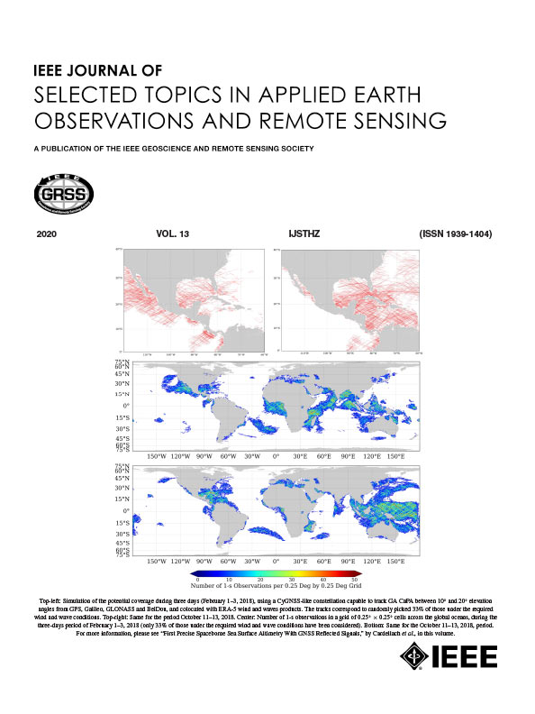 Change Detection Based on Low-Level to High-Level Features Integration With Limited SamplesIEEE Journal of Selected Topics in Applied Earth Observations and Remote Sensing, Oct 2020
Detailed land cover change in multitemporal images is an important application for earth science. Many techniques have been proposed to solve this problem in different ways. However, accurately identifying changes still remains a challenge due to the difficulties in describing the characteristics of various change categories by using single-level features. In this article, a multilevel feature representation framework was designed to build robust feature set for complex change detection task. First, four different levels of information from low level to high level, including pixel-level, neighborhood-level, object-level, and scene-level features, were extracted. Through the operation of extracting different level features from multitemporal images, the differences between them can be described comprehensively. Second, multilevel features were fused to reduce the dimension and then used as the input for supervised change detector with initial limited labels. Finally, for reducing the labeling cost and improving the change detection results simultaneously, active learning was conducted to select the most informative samples for labeling, and this step together with the previous steps were iteratively conducted to improve the results in each round. Experimental results of three pairs of real remote sensing datasets demonstrated that the proposed framework outperformed the other state-of-the-art methods in terms of accuracy. Moreover, the influences of scene scale for high-level semantic features in the proposed approach on change detection performance were also analyzed and discussed.
2019
-
 Change detection in high-resolution images based on feature importance and ensemble methodArabian Journal of Geosciences, Jul 2019
A robust framework for change detection in high-resolution (HR) images which takes into account feature importance of morphological attribute profiles (APs) is proposed. Although APs allow the discriminative extraction of geometrical features, the selection of optimal filtering thresholds is always a challenging task. In order to address this problem, the importances of multi-attribute APs, which are generated by ranges of thresholds, are calculated in advance. The APs with higher importances are chosen as input features for change detectors. Furthermore, owing to the possible incomplete feature importance model caused by randomness and small size of selected training samples through random forest, an ensemble method is conducted by integrating different results to enhance the stability of the final output. Experimental results obtained by two pairs of bi-temporal HR images demonstrate the effectiveness of the proposed approach.
-
 Unsupervised Change Detection in VHR Images Based on Morphological Profiles and Automated Training Sample ExtractionIn 2019 10th International Workshop on the Analysis of Multitemporal Remote Sensing Images (MultiTemp), Aug 2019
VHR remote sensing image change detection with pixel-based method often results in some problems that have negative effects on accuracy, such as the salt-and-pepper noise. In order to achieve a better result under this circumstance, an unsupervised sequential strategy combining Morphological Profiles and automated training sample extraction is introduced. Change detection with two real multi-temporal VHR datasets were carried out to test the effectiveness of the proposed approach. The experimental results showed that this approach outperformed the traditional unsupervised change detection methods in terms of accuracy and visual effect.
2018
-
 Object-Based Change Detection in Urban Areas from High Spatial Resolution Images Based on Multiple Features and Ensemble LearningRemote Sensing, Feb 2018
To improve the accuracy of change detection in urban areas using bi-temporal high-resolution remote sensing images, a novel object-based change detection scheme combining multiple features and ensemble learning is proposed in this paper. Image segmentation is conducted to determine the objects in bi-temporal images separately. Subsequently, three kinds of object features, i.e., spectral, shape and texture, are extracted. Using the image differencing process, a difference image is generated and used as the input for nonlinear supervised classifiers, including k-nearest neighbor, support vector machine, extreme learning machine and random forest. Finally, the results of multiple classifiers are integrated using an ensemble rule called weighted voting to generate the final change detection result. Experimental results of two pairs of real high-resolution remote sensing datasets demonstrate that the proposed approach outperforms the traditional methods in terms of overall accuracy and generates change detection maps with a higher number of homogeneous regions in urban areas. Moreover, the influences of segmentation scale and the feature selection strategy on the change detection performance are also analyzed and discussed.
-
 青藏高原地表冻融循环与植被返青期的变化趋势及其气候响应特征王欣, 晋锐*, 杜培军, and 1 more author遥感学报, Jun 2018
青藏高原特殊的地理环境使其对全球气候变化十分敏感,所以研究其地表冻融循环和植被返青期的时空动态对于回顾和预测青藏高原对全球气候变化的响应具有重要意义。本文通过利用双指标地表冻融状态识别算法和被动微波亮温数据(SMMR、SSMI和SSMIS)来获取青藏高原长时间序列(1982年—2013年)逐日地表冻融状态,通过对GIMMS全球植被指数数据产品进行NDVI的滤波重建和返青期提取来获取青藏高原植被长时间序列(年份)的返青期;并且分析了地表冻融循环和植被返青期的变化趋势、相互关系及对青藏高原气候变化的响应特征。总体来看,在空间上,青藏高原的地表冻结集中发生在10月30日至次年4月2日,平均地表融化首日集中在5月12—27日,平均植被返青期集中在5月19—29日。植被返青期平均发生在地表融化首日后的3.94±5.58日,两者具有显著的相关关系(R=0.51,P=0.003)。青藏高原的地表融化首日和植被返青期在1982年—2013年间经历了推迟、提前再推迟的3个过程,融化时间和返青期在1982年—1987年分别以1.93±1.81 d/a和0.28±1.01 d/a的速度推迟;在1987年—2006年分别以0.67±0.20 d/a和0.13±0.16 d/a的速度提前;在2006年—2013年分别以0.97±0.84 d/a和1.04±0.52 d/a的速度推迟。中国气象局布设在青藏高原的CMA气象站的温度数据表明,高原的春季地表0 cm土壤温度呈持续上升的趋势,而植被返青期和地表融化首日并未持续提前,这可能是由几十年来高原不同地区降水等其他环境因素变化的差异造成。同时在气温持续升高期间,植被返青期的返青温度阈值也不断具有上升的趋势(R=0.72,P<0.001),这可能与植被适应气候变化的自身调节能力有关。
